For Tampa Bay, Helene was the worst storm in a century
Published in News & Features

TAMPA, Fla. — Tampa Bay’s regulars — our barkeeps, retirees, refugees — all had the same reaction this week in the aftermath of Hurricane Helene, no matter what part of the region they call home.
Surprise.
Never seen it this bad.
Never seen water so high.
Never seen it come anywhere close to our door.
No one expected this.
All my life and it’s never flooded.
Hurricanes aren’t new here. But late Thursday, after a long day in Tampa Bay of been-there-done-that winds, the Gulf of Mexico’s midnight black saltwater, pushed for miles by Helene’s force, finally ran out of room.
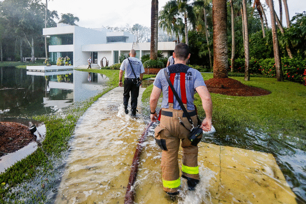
It unleashed over seawalls and into neighborhoods and homes, in some places reaching 7 feet above ground.
At least 11 people are dead in Tampa Bay, more than 1,000 were rescued and tens of thousands saw flooding at their homes.
Add it all up, and what its residents intuited is undeniable: Tampa Bay just had its worst hurricane in a century.
In living memory, plenty of major hurricanes have threatened this region before decimating other places, and plenty of unassuming tropical storms punched above their weight.
But for Tampa, St. Petersburg and every other waterfront community here, Hurricane Helene’s impact is unmatched since 1921.
To make that determination, the Tampa Bay Times analyzed historical storm data, surge readings, building footprints in flood zones and government accounts of damage and death.
Helene’s deadly cocktail — comprising ingredients that are each familiar to past Gulf storms — brewed record surge and historic damage. Even while the storm’s eye stayed 100 miles off shore.
Here’s how it happened.
More at risk
Tampa Bay’s last direct hit was in October 1921. Decades before hurricanes had names, one beelined for Tarpon Springs, where it made landfall as a Category 3 storm. It damaged buildings from Pass-A-Grille to Ybor and drove 10 feet of surge into the bay. Eight people died in Florida.
Back then, Pinellas County had about 30,000 people. Hillsborough housed another 90,000.
Today, a dense metropolis drapes the bay, and much more is at risk.
The counties are home to 2.5 million people, having grown 20 times over. They live on flat land and barrier islands, along the gulf’s shallow continental shelf, which serves as an onramp for flooding during storms.
Together, those characteristics make the region more vulnerable to storm surge than just about anywhere else in the nation.
Helene has already killed more people in Tampa Bay than the 1921 hurricane.
“A strike on Tampa Bay has always been seen as a megadisaster for Florida, not only because of the geography, but also because of the very large population,” said Jay Barnes, a hurricane historian in North Carolina.
The region’s iconic beach bars and glitzy condos in flood zones form a disproportionate share of Florida’s property tax base.
“Our homes are a lot more expensive today than they were in 1921,” said Barnes, who authored Florida’s Hurricane History.
He agreed that was the last time a storm rivaled Helene’s damage here.
Both storms developed in the western Caribbean, ambling through the Yucatán Channel and swelling into major hurricanes.
The initial carbon-copy routes of Helene and the 1921 storm split 150 miles west of Fort Myers.
There, Helene veered left, and her predecessor went right.
Helene, like every hurricane since, was not a direct hit on Tampa Bay. But two factors made up for that — an unprecedented combination of size and path.
An immense storm
The most well-known statistic about a hurricane is typically its wind speed at the eyewall. Those maximum winds, after all, determine its category.
But Helene’s winds extended hundreds of miles. It was wider than 90% of recent Gulf hurricanes. It made recent storms, like Ian and Idalia, look small. Its size ranks among those that have become household names, like Katrina.
Helene’s immense wind field pushed lots more water toward shore, said Matt Bilskie, a storm surge modeler and assistant professor at the University of Georgia.
Water swept toward Florida, then piled up along the Gulf Coast like dust in a dustpan.
Surge inundated Tampa Bay, setting records at all area water gauges, even one that’s recorded data since the 1940s. Water peaked at 7.2 feet above normal high tide.
To estimate the scope of the damage, The Tampa Bay Times analyzed detailed flood forecasts from Thursday evening, hours before landfall. The National Hurricane Center data show, for any given location, reasonable worst-case flood levels. The Times compared those to maps of nearly every building footprint in Tampa Bay.
Of more than 330,000 buildings in Pinellas County, nearly 1 in 10 were on land set for serious flooding from Helene, the Times found. Those 33,000 structures were forecast to see up to 6 feet of water above ground — or more.
Not all counted buildings would have water inside; many homes and businesses near the water are elevated.
In Hillsborough and Pasco counties, 1 in 15 buildings were in such potential flood areas — totaling more than 60,000 properties at risk in the region.
Those numbers were even more stark in evacuation Zone A. Across the three counties, more than 4 in 10 buildings in the zone were on land facing 6-foot flooding potential or higher. Within Pasco’s zone, the number was even higher: 7 in 10.
Pinellas and Pasco modeled similar damage predictions.
After the storm, Pinellas officials said within St. Petersburg alone, 10,000 homes flooded. Throughout the rest of the county, they’ve assessed about 5,000 structures so far with major or minor damage, including dozens that were deemed destroyed.
Pasco received more than 8,700 damage reports. Hillsborough officials reported at least 1,200 damaged homes.
Officials say all the counts are preliminary, as of Saturday morning, and will increase.
The wrong track
Look at the images from the southeast of Helene’s landfall, and it’s clear why it’s called “the dirty side” of a storm.
Hurricanes, spinning counterclockwise, blow air and water forward on their right side. At the same time, the storms move forward, making right-side winds and surge the strongest.
A track like Helene’s — aiming toward Florida’s Big Bend from Mexico — is particularly dangerous for our region.
“Tampa doesn’t need a direct strike,” Bilskie said.
Landfalls to its north are the region’s worst-case scenarios. Hurricane experts have long feared a medium-strength storm landing as far north as Cedar Key and catching Tampa Bay off guard.
It’s a path that has scared this region again and again. As recently as August 2023, Hurricane Idalia barreled up the coastline and flooded thousands of homes. Debby took a similar path last month.
But Helene was the strongest storm on record to make landfall in the Big Bend.
Slight changes in track mean a world of difference in potential damage, but people don’t always remember them. Hurricanes Irma and Charley headed toward Tampa Bay before turning inland to the south and largely sparing the region.
Those who benefit from last-minute turns might become complacent in the future, Barnes said.
“People aren’t necessarily studying the meteorology. They weathered the storm, they made it out OK, they picked up some limbs, and they think they lived through a hurricane.”
But Helene was different.
Toll only beginning
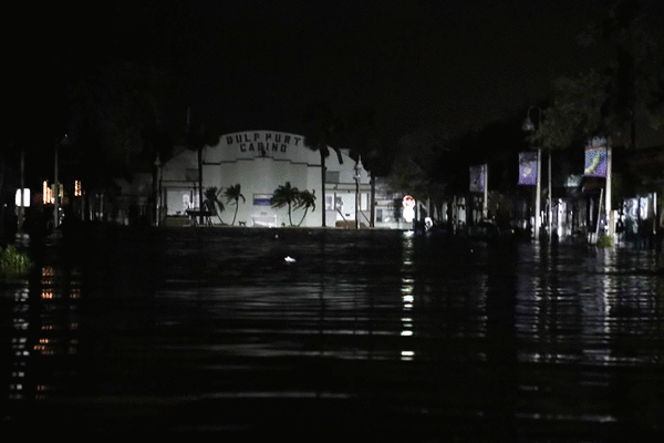
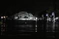
The water fell in Tampa Bay as the sun rose Friday. Those unscathed woke up to see the damage from drone photos and Instagram reels.
It was a first-in-a-lifetime sight for locals: one of Florida’s biggest metros nursing its most severe injury in 100 years.
Water threatened area landmarks like the Vinoy hotel, the Don CeSar and Safety Harbor’s Municipal Fishing Pier. The storm thrashed beloved beach bars like Crabby’s on the Pass and O’Maddy’s Bar and Grille.
Overnight, across the region, hundreds of thousands went without power.
In St. Petersburg, people called for help 1,700 times. A half-dozen homes caught fire. Sixty-five power lines went down across the city along with 160 trees. Crews performed more than 80 water rescues.
In Hillsborough, 47 homes burned — a dozen at the same time. Two hundred fifty people called 911 for help, nearly half needing rescue.
Many evacuees still wait to inspect their own homes. The barrier islands remained closed on Saturday, evacuation orders still in place.
As the damage toll has grown, so has the number of deaths.
Eleven people across Hillsborough and Pinellas were confirmed dead in the storm as of Saturday afternoon. At least nine would be considered “direct” deaths — people who were hurt by the storm itself. At least seven drowned.
No direct storm deaths were reported in Hillsborough, Pinellas or Pasco as a result of Hurricanes Charley, Irma, Michael or Ian — the region’s most notable storms.
Search and rescue crews continued to make their way through the wreckage Saturday.
Every government official speaking about damage has stressed that it’s still too early to understand the full extent. There are blocks they haven’t been to, homes they haven’t searched. The toll, they say, has only begun.
———
(Times staff writers Lane DeGregory, Olivia George, Divya Kumar, Tracey McManus, Michaela Mulligan, Lauren Peace, Teghan Simonton, Christopher Spata and Dan Sullivan contributed to this story.)
———
©2024 Tampa Bay Times. Visit tampabay.com. Distributed by Tribune Content Agency, LLC.


Comments