Atmospheric river storm slams into LA County, bringing mudslides and flooding, and trapping cars
Published in Weather News
LOS ANGELES — Just a month after fierce Santa Ana winds propelled a firestorm across Los Angeles County, residents faced another extreme weather event Thursday. The biggest storm of the season so far hit Southern California, bringing with it mudslides and flooding, and reports of trapped vehicles.
The rain sent a cascade of mud and water from a hillside onto Pacific Coast Highway in Malibu on Thursday afternoon. The scenic highway will remain closed between Chautauqua Boulevard and Carbon Beach Terrace until at least 6 a.m. Friday, according to the California Department of Transportation.
Around 12:25 p.m., firefighters rushed to the Elysian Valley after receiving reports of a small white pickup truck trapped in water at 3050 N. Coolidge Ave., according to the Los Angeles Fire Department. Then, at 12:40 p.m., crews responded to a similar report of a silver SUV that was partially submerged in rushing water near Parthenia Street and Noble Avenue in Panorama City. It was not immediately clear whether anyone had been trapped in the vehicles.
As of midafternoon Thursday, rain had fallen in some areas at rates close to three-quarters of an inch per hour, and CalTrans crews were working at many locations to clear debris from roads and reduce flooding.
At 3:30 p.m., the National Weather Service warned of a band of heavy rain moving into Los Angeles County in the next hour or two, bringing the potential of more intense rain, with rates as high as an inch per hour.
“Expect a rapid enhancement of rain with increased road flooding and risks of burn scar debris flows,” the weather service said.
On Thursday morning, Jude Bell sat in her SUV — shielded from the steady drizzle that dampened her red brick home in Altadena — making a list of what needed to be done as she waited for a contractor to arrive.
Her home on Alameda Street, unlike many others a block away, was still standing after the devastating firestorm that tore through the San Gabriel Valley community and left death and destruction in its wake.
Parts of her home were damaged by the powerful Santa Ana winds that accompanied the inferno, and the inside has a lingering smoky smell. A month after the fire, she’s still grappling with her insurance company to get things fixed, and she’s worried about toxic compounds in the soil.
Amid all this, the impending rain felt like just another hurdle. The storm wasn’t top of mind, even as experts warned the rain could unleash destructive debris flows, potentially dealing another devastating blow to the ailing community.
“Who knows?” Bell said with a hint of exhaustion. “The fire wasn’t front of mind, either. I didn’t think my house would be damaged by fire.”
Atmospheric rivers that dropped modest rain across Los Angeles County earlier this month didn’t result in significant damage. But on Thursday, the strongest storm of the winter was set to unleash heavy rain across the fire zones, prompting evacuations and officials rushing to secure vulnerable neighborhoods.
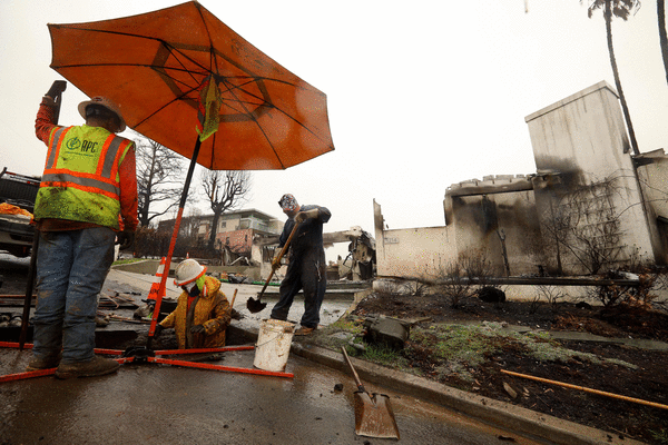
In the San Gabriel Valley, where the Eaton fire charred a devastating path — leveling more than 9,400 structures including many homes and killing 17 people — a state report noted that there’s a high likelihood that heavy rain could generate large, damaging post-fire flooding and debris flows.
On the Westside, where the Palisades fire burned hillside communities all the way to the Pacific Ocean, officials were also preparing for rockslides, debris flows and flooding.
“If those heavy rain areas set up over some of the burn scars — such as the Palisades burn scar, Eaton burn scar and other burn scars across the greater Los Angeles area — there will be the potential for very severe debris flows to occur in addition to mudslides and rockslides,” Ariel Cohen, the meteorologist in charge of the National Weather Service Los Angeles/Oxnard office, said during a news conference Thursday.
“Again, that’s an uncertain situation — far from certain right now — but everyone needs to be at a high state of readiness as we head through the afternoon and evening hours,” Cohen said.
Forecasters warned that conditions could deteriorate quickly with little warning and suggested people park away from trees, charge electronics and be prepared to evacuate quickly if needed.
Customers at Ace Hardware in Altadena had been coming in to grab materials such as tarps and sandbags to protect their damaged homes from the elements.
They’d also been venting and crying, said cashier Paola Vargas, 25.
“They’re scared; we’re all a bit scared,” said Vargas, who also lives in Altadena. “First we had to evacuate because of the fire and now we’re preparing for a flood?”
Her home survived the fire but was damaged by smoke, so her family ended up throwing out much of their belongings as trash.
“I don’t think it’s ever going to be the same again,” she said. “My house is still there, but seeing many neighbors’ homes that are gone, it feels empty. It doesn’t feel the same, very quiet.”
Across Los Angeles County, sheriff’s deputies and police officers went door to door to warn residents at greatest risk of being hit by a debris flow that they should evacuate or at least prepare to leave quickly.
Mandatory evacuation orders were issued for 106 homes in Pacific Palisades, nine homes in the Sunset fire area and four homes in the Hurst fire zone, said Los Angeles Police Department Chief Jim McDonnell.
“These are mandatory evacuations, not warnings,” he said. “Residents must leave for their safety. We understand that evacuations are difficult, but this is all about keeping our community safe.”
In areas patrolled by the L.A. County Sheriff’s Department — Malibu, Altadena, San Dimas and Palmdale — 98 residences were under mandatory evacuation orders, according to sheriff’s spokesperson Nicole Nishida.
Evacuation warnings were also issued in a number of burned areas, including Brentwood, Sunset Mesa, Hollywood and Hollywood Hills West, Sylmar, Calabasas, Kinneloa Mesa, Arcadia, Sierra Madre and the San Gabriel Mountains, including Mount Baldy Village and Wrightwood.
On Thursday afternoon, strong thunderstorms were hitting Santa Barbara and San Luis Obispo counties, the weather service said, with forecasts of wind gusts of up to 55 mph and pea-sized hail.
Farther south, in Orange County, the persistent rain prompted evacuations, and Knott’s Berry Farm closed.
In the area where the Airport fire charred the hillsides above Trabuco Canyon in September, officials issued a mandatory evacuation order for the RC Airport, fire station, campground/park and school, Bell Canyon and Hot Springs Canyon.
Recently burned areas are at risk for landslides in heavy rains, with soil no longer anchored by verdant vegetation. The heat from fire makes it harder for soil to absorb water, which can leave hillsides vulnerable to erosion. This can result in slopes crashing down in a torrent of mud, rocks and dead branches that can move as fast as 35 mph, imperiling homes — or people — in their path.
Months after the 160,557-acre Station fire of 2009, the largest wildfire in L.A. County history, a major debris flow on Feb. 6, 2010, inundated more than 40 homes in La Cañada Flintridge’s northernmost neighborhood with mud and boulders.
The culprit was an intense band of rain cells that formed over the burned mountains and a 10-ton boulder that had plugged up the Mullally Canyon debris basin, which was designed to catch ashen mud as it poured from the slopes. Officials later built a $1.5-million drain pipe to divert rainwater away from the basin and worked to increase storage capacity of the area’s catch basins.
Although all recently burned areas are of concern, the Eaton fire, Palisades fire and Bridge fire burn scars are at highest risk of damage with this storm, forecasters say.
According to data compiled by the U.S. Geological Survey, a rainstorm that delivers a peak 15-minute rainfall intensity of 1.57 inches per hour would have an 80% to 100% chance of generating debris flows across much of the Eaton fire area.
In the Palisades, a rainstorm that unleashes a peak 15-minute rainfall intensity of 0.94 inch per hour would have a 60% to 80% chance of resulting in debris flows along a swath of Tuna Canyon Park, Temescal Canyon and above the Pacific Palisades. Portions of hillsides above Malibu and in the Mandeville Canyon area are at even higher risk, according to USGS data.
The Eaton burn scar could see peak rain rates of 0.85 of an inch per hour, while the Palisades scar could see 0.79 of an inch per hour during the storm. Experts say that when rain falls at half an inch per hour or more, debris flows could be triggered in recently burned areas.
For most of the peak time of the storm, rain is forecast to fall at more modest rates of a quarter of an inch to half an inch per hour, said Ryan Kittell, a meteorologist with the National Weather Service.
But it’s the brief bursts of heavy rain that could pose the most problems.
“We really could see those anywhere,” Kittell said. “It just won’t be necessarily widespread. It just depends on where those heavier [storm] cells ... materialize.”
The storm is expected to move out of the region on Friday, ushering in another potentially extended period of dry weather for the rest of February.
_____
©2025 Los Angeles Times. Visit at latimes.com. Distributed by Tribune Content Agency, LLC.


Comments