Will remnants of Hurricane Francine reach the Kansas City area? What the forecast says
Published in Weather News
KANSAS CITY, Mo. — Dry and warmer-than-usual weather is expected in the Kansas City area over the next couple of days before a chance of rain moves in for the weekend, according to the National Weather Service.
Wednesday’s sunny skies are expected to make it the hottest day of the week, with temperatures climbing just shy of 90 degrees. Typically, Kansas City’s temperatures are around 80 degrees this time of year.
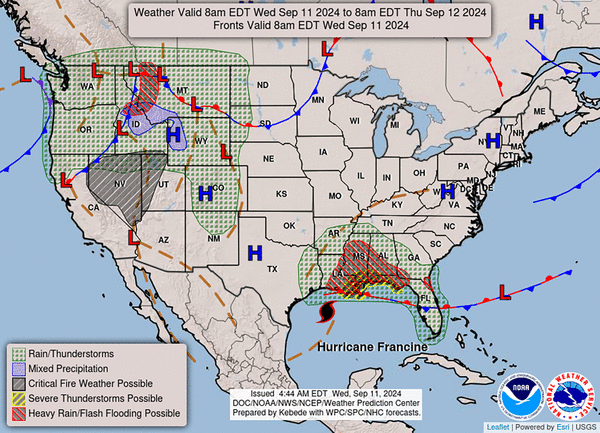
Warmer-than-average weather continues Thursday. The weather service said temperatures will not be as hot as clouds move in as the remnants of Hurricane Francine, the sixth named storm of 2024, move northward through the Mississippi River Valley.
Remnants of Hurricane Francine in Missouri
The remnants of Francine are expected to drift into southeast Missouri and may bring a chance of light rain to central Missouri, primarily east of U.S. 65 highway, the weather service said. Areas along Interstate 44 have the potential to see the heaviest rainfall.
The weather service said temperatures will be cooler on Friday, reaching only the mid-70s east of U.S. 65 and the low 80s for the Kansas City metro.
The weekend will bring temperatures in the mid- to upper 80s under sunny skies. While there may be lingering light rain in far eastern counties, the weather service said most of the Kansas City forecast area is expected to remain dry.
As of Wednesday morning, Hurricane Francine had maximum sustained winds of 90 miles per hour and was 195 miles southwest of Morgan City, Louisiana, according to the National Hurricane Center.
©2024 The Kansas City Star. Visit at kansascity.com. Distributed by Tribune Content Agency, LLC.


Comments