Hurricane center says Atlantic system's chances to develop have fallen
Published in News & Features
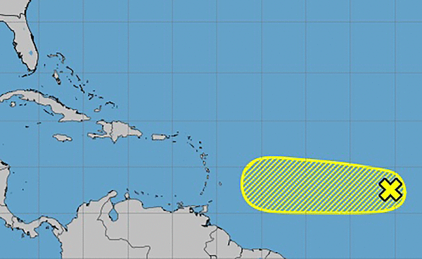
The National Hurricane Center on Saturday continued to track an Atlantic system moving toward the Caribbean but now only forecasts a low chance it could form into the season’s next tropical depression or storm.
As of the NHC’s 2 p.m. outlook, the tropical wave dubbed Invest 91-L in the central tropical Atlantic had just a small area of showers and thunderstorms.
“Environmental conditions are only marginally conducive for development, and the chances of this system becoming a tropical depression continue to diminish,” forecasters said. “The wave is expected to move generally westward at 10 to 15 mph.”
It’s forecast to be near the Lesser Antilles by the middle to late part of next week.
The NHC gave the disturbance a 20% chance to develop over the next two to seven days. That was down from predictions earlier in the week that went as high as 90%.
The National Weather Service in Melbourne said it’s too early to say if the system will have any impact on Florida.
If it develops, it would be the seventh tropical cyclone of the season and have the name Gabrielle.
Only one of the six named storms this season — Hurricane Erin — reached hurricane status and it grew to a powerful Category 5 storm with 160 mph winds but never made landfall.
The National Oceanic and Atmospheric Administration in early August updated its season forecast to call for 13-18 named storms this year, of which five to nine would grow into hurricanes. Two to five of those would develop into major hurricanes of Category 3 or higher.
The height of hurricane season runs from mid-August into October while the entire six-month season runs June 1 to Nov. 30.
_____
©2025 Orlando Sentinel. Visit orlandosentinel.com. Distributed by Tribune Content Agency, LLC.


Comments